Reine to Hamnøy viewpoint walk in Lofoten
About 5.7 km each way along the E10 from Reine over Sakrisøy to the bridge views at Hamnøy: free, about 70 minutes each way at a steady pace, any month.
By supjourney editorial team · published 26 October 2026 · facts checked 1 November 2026 · 2 min read
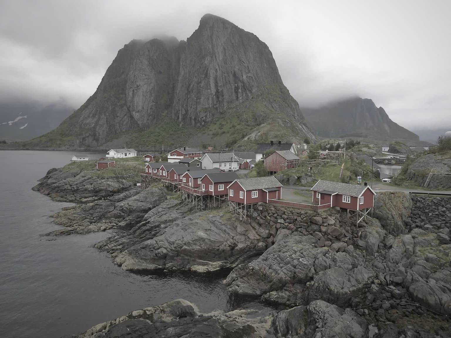
The walk from Reine to Hamnøy is the free, flat way to see the two views most people come to the bottom of Lofoten for: Reine across the water from Sakrisøy, and the red cabins of Hamnøy under the mountain wall from the bridges. It is about 5.7 km each way along the E10 and 71 minutes at a steady pace, computed below, so a return trip with stops is a morning. It suits anyone sleeping in Reine, in any month, and anyone who does not want to climb Reinebringen. It does not suit small children in the dark months, because the route is a road.
What the authority says: Nasjonale turistveger, the roads administration's scenic-routes office, gives the Lofoten scenic route as 230 km, lists Reinehalsen and Akkarvikodden among its rest areas and viewpoints in the south, and names Reine and Hamnøy among the places with motorhome dump stations, which it says may not be emptied in its toilets. The Reine stop has the road and ferry context: the E10 and the scenic route are open all year, and the Bodø–Moskenes ferry lands a short drive away.
The arithmetic
The OSRM foot profile returned no route on these islands today, so the distance is measured on the road the walk follows: OSRM over OpenStreetMap gives Reine to Sakrisøy 4,172 m and Sakrisøy to Hamnøy 1,480 m, 5,653 m in all (computed 1 November 2026). At 80 m a minute that is 71 minutes one way and 141 return. Add an hour of stops and photographs: 210 minutes, which is what the walk costs a Reine day. By car the same stretch is about 10 minutes.
The light decides when to go. Computed with the NOAA solar equations for Reine on a flat horizon (the mountains cut it further): the sun does not rise from 10 December 2026 to 2 January 2027; on 5 December it is up from 11:07 to 12:50, on 1 February from 09:25 to 15:18, on 1 March from 07:27 to 17:13. It does not set from 27 May to 16 July 2027. In December and January, walk in the blue midday hours with a headtorch for the return; in June and July, walk when the coaches are not stopping, early or late.
What goes wrong
Traffic, first: the E10 is the only road and it carries summer coaches and motorhomes. Wind on the bridges, second, which the Reine stop names as the winter hazard on this coast. Dark, third: from late November to mid January most of the walk is in twilight or night. Reinebringen, fourth, for anyone tempted up it in the wrong season: Visit Lofoten strictly does not recommend it in winter and warns of summer closures for step work.
Alternatives on the same road
From the water: the Lofoten Trollfjord RIB further north. For the winter drive and the Bodø ferry in the dark season: Lofoten in winter. For the aurora further north: Tromsø aurora chase.
Questions people ask
Is there a footpath?
Where is the classic view?
Should I climb Reinebringen instead?
Can I drive it instead?
Sources we checked
Something changed here? Tell us; we re-check against the source and print the new date.
hike · Norway · Nordland
The arithmetic
- Time needed
- 2.5–3.5 h
- Adds to a driving day
- 3 h 30 min, door to door
- Price
- Free — Free. Parking in Reine village is charged in season (see the Reine stop). Reinebringen, the steep alternative above the village, is free: 2 km return, 1,974 steps on the January 2024 count, 1–2 hours, May–September (visitlofoten.com, read 2026-11-01).
- Season
- All year on the road: the E10 and the Lofoten scenic route are open all year (Nasjonale turistveger). Computed for Reine, the sun does not rise from 10 December 2026 to 2 January 2027 and does not set from 27 May to 16 July 2027
- Book ahead
- None
- Best time
- Early morning or late evening in June and July; around midday in late November and January, for the low light
- From
- Reine, Lofoten
- Checked
- 1 November 2026
What this page adds
The walk measured on the road that carries it — OSRM over OpenStreetMap gives Reine to Sakrisøy 4,172 m and Sakrisøy to Hamnøy 1,480 m, 5,653 m each way and 71 minutes at 80 m a minute (1 November 2026) — set against Reine's computed light: polar night 10 December–2 January, midnight sun 27 May–16 July.
More: waterfalls and walks