Djúpalónssandur beach and the Dritvík path
A free hour on the black pebble cove in Snæfellsjökull National Park: the fishermen's lifting stones, rusted wreck pieces and a 1 km path to Dritvík.
By supjourney editorial team · published 30 October 2026 · facts checked 1 November 2026 · 3 min read
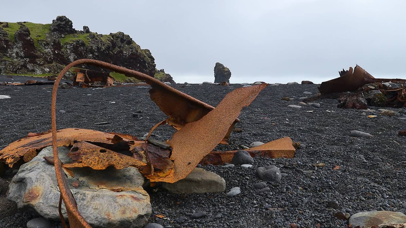
Djúpalónssandur is a black pebble cove at the south-west tip of Snæfellsnes, inside Snæfellsjökull National Park, and the walk is a short one: down from the car park to the beach, past the boulders fishermen once lifted to prove their strength and the rusted iron of a wrecked trawler, then 1 km along the coast to the bay of Dritvík and back. It costs nothing, suits anyone who can manage an uneven path, and is the one stop on the outer cape where an hour feels short. It does not suit a stormy day with small children: the sea here is open Atlantic.
The figures, read today on the Environment Agency's park pages. The FAQ says the park is free for anyone to visit and has no opening hours; trail maps cost 400 ISK at the Malarrif visitor centre (read 2026-11-01). Toilets at the Djúpalónssandur car park are open in summer; those beside the Malarrif visitor centre are open 24 hours, every day of the year. Camping and overnight stays inside the park are not allowed. The paths page calls the Djúpalónssandur–Dritvík path easy and popular, gives it as 1 km, and says the whole route on to Sandhólar is 4 km. It notes an old labyrinth made by fishermen on Suðurbarði and says Dritvík held up to 600 people in the fishing season in the 18th century; the history page puts the station at 40 to 60 boats at its height. The agency does not publish names or weights for the lifting stones, nor the history of the wreck, so neither is given here.
The arithmetic
On the ten-day Ring Road with Snæfellsnes, day 8 runs Borgarnes to Stykkishólmur round the cape and lists Arnarstapi and the national park, so the beach is on the road: 60 minutes for the beach and the Dritvík path and a 15-minute buffer for the car park, about 75 minutes. From Arnarstapi the car park is 16 km and about 15 minutes by OSRM on OpenStreetMap. As a separate trip from a Stykkishólmur bed it is 102 km and about 90 minutes each way, so 180 minutes on the road, 60 on foot and 15 of buffer: about 255 minutes. From Borgarnes it is 134 km and about 115 minutes each way, which belongs on the loop day rather than as an out-and-back.
What goes wrong
Waves: Safetravel's beach page, written for Reynisfjara, describes sneaker waves that surge far beyond the ordinary surf and can take an adult out to sea in seconds. Djúpalónssandur faces the same ocean. Stay well back from the wet pebbles and never turn your back on the water. Weather: the park's FAQ advises reading the weather conditions before going out, and the cape catches wind that the north coast does not. Winter: the summer toilets are shut, daylight is short, and the path down to the beach can ice. Damage: the park FAQ warns that the land is extremely fragile in many places and that reckless driving does lasting harm; stay on the road and the paths.
Alternatives on the same road
A few minutes east, Vatnshellir is the guided lava-tube descent inside the same park. On the north coast, the Kirkjufellsfoss walk is the other short stop of the loop day, with a parking fee. At the end of the day, Stykkishólmur has the Breiðafjörður boat.
Questions people ask
Can I try the lifting stones?
What is the wreck?
Are there toilets?
Is the beach safe for children?
Sources we checked
- Environment Agency of Iceland — Snæfellsjökull National Park, paths and tracks, read 2026-11-01
- Environment Agency of Iceland — Snæfellsjökull National Park FAQ (fees, toilets, hours), read 2026-11-01
- Environment Agency of Iceland — Snæfellsjökull National Park history (Dritvík), read 2026-11-01
- Safetravel — black beach safety and sneaker waves, read 2026-11-01
Something changed here? Tell us; we re-check against the source and print the new date.
hike · Iceland · Snæfellsnes
The arithmetic
- Time needed
- 45–90 min
- Adds to a driving day
- 4 h 15 min, door to door
- Price
- Free — No entry fee to Snæfellsjökull National Park (ust.is FAQ, read 2026-11-01); no parking fee listed on the Environment Agency's pages. Trail maps 400 ISK at the Malarrif visitor centre.
- Season
- All year; car-park toilets in summer only
- Book ahead
- None
- Best time
- Low wind and a falling tide, in daylight
- From
- Djúpalónssandur
- Checked
- 1 November 2026
What this page adds
A 75-minute cost on day 8 of the ten-day Ring Road, where route 574 already passes the car park (60 minutes on the beach and the Dritvík path, a 15-minute buffer), against 255 minutes as a return trip from Stykkishólmur (102 km and 90 minutes each way by OSRM on OpenStreetMap).
Which day of which journey
The first ledger day that reaches Djúpalónssandur, and what it costs that day: 4 h 15 min door to door.
- Iceland Westfjords loop in 6 days
Day 1 of 6: Reykjavík → Patreksfjörður, night in Patreksfjörður
1,020 kmChecked 1 November 2026 - Iceland Ring Road in 10 days with Snæfellsnes
Day 8 of 10: Borgarnes → Stykkishólmur, night in Stykkishólmur
2,160 kmChecked 1 November 2026
More: waterfalls and walks