Dimmuborgir lava-formation trails at Mývatn
Marked loops of about 30 and 60 minutes through lava pillars and arches, 10 minutes from Reykjahlíð; walking free, any parking charge unconfirmed on 1 November 2026.
By supjourney editorial team · published 29 October 2026 · facts checked 1 November 2026 · 2 min read
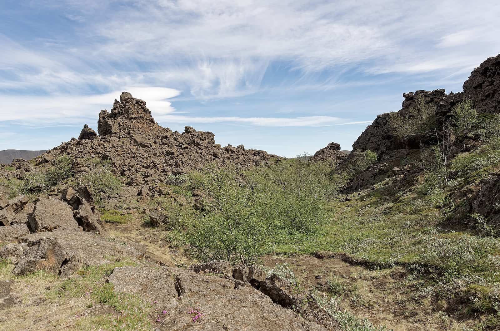
Dimmuborgir is a field of lava pillars, arches and caves on the east side of Mývatn, threaded with marked loops of about 30 and 60 minutes. Walking it is free by the Environment Agency's page; whether the car park charges could not be confirmed on any official page today. It suits a short morning before leaving Mývatn, families with children who can walk an hour, and a grey day when the views elsewhere are gone. In deep winter the paths can be impassable.
The figures, read today: the Environment Agency of Iceland (Umhverfisstofnun) says Dimmuborgir was protected as a natural monument in 2011, covers about 423 hectares, and has been managed by the Soil Conservation Service since 1942, when local landowners handed it over. A paved road leads in from Geiteyjarströnd to a car park beside a service building with toilets, food and a shop. Visitors follow the marked trails; damaging formations or plants, camping and dogs without a special permit are not allowed. The page warns that snow, ice and slush ponds can limit and even prevent walking. Visit Mývatn, the local tourist office, gives the small circle as about 30 minutes and the big circle, to the formation called the Church, as about an hour, with maps at the junctions and most routes easy. The Environment Agency's page notes that its site is being replaced by new pages for the Environment and Energy Agency and the Nature Conservation Agency, so the address may move. No official page stating a parking fee or its operator could be found or read on 1 November 2026, which is why this page is marked for checking.
The arithmetic
Reykjahlíð is the sleep town on day 4 of the seven-day Ring Road, day 5 of the ten-day Ring Road, day 2 of the five-day North and Diamond Circle and day 6 of the Iceland and Faroe Islands ferry journey. From there the car park is 6.5 km and 10 minutes each way by OSRM on OpenStreetMap. The big loop is an hour, the service building about 10 minutes and a 15-minute buffer: about 105 minutes. The small loop brings it to about 75. Because every Mývatn ledger day lists the lake as a stop, either figure is time spent rather than distance added.
What goes wrong
Winter: the agency's own warning is that snow, ice and slush can stop the walk; the lava is sharp underfoot when the path is buried. Crowds: the agency says December is busy with the Yule Lads. Weather: safetravel.is advises checking the forecast every day and carrying a hat, gloves and windproof layers on any walk, however short. Fees: the parking question is open; if there is a machine, its sign is the authority.
Alternatives on the same road
On the same side of the lake, the Earth Lagoon is the warm finish. North on road 862, the Dettifoss to Selfoss loop is an hour's walk 45 minutes away. East of Námafjall, Hverir is the steaming ground beside Route 1.
Questions people ask
How long are the trails?
Is there a fee?
Can I bring a dog?
What happens at Christmas?
Sources we checked
Something changed here? Tell us; we re-check against the source and print the new date.
hike · Iceland · North
The arithmetic
- Time needed
- 30–75 min
- Adds to a driving day
- 1 h 45 min, door to door
- Price
- Price not published — The Environment Agency's page lists no fee for the protected area (read 2026-11-01); a parking charge is reported by third parties, but no operator or official page stating one could be found or read on 2026-11-01.
- Season
- All year; snow, ice and slush ponds can limit or prevent walking in winter
- Book ahead
- None; walk-in
- Best time
- Early morning or evening in summer; midday in winter for the light
- From
- Mývatn (Reykjahlíð)
- Checked
- not yet confirmed on an official source
What this page adds
A 105-minute cost from a Reykjahlíð bed for the big loop (6.5 km and 10 minutes each way by OSRM on OpenStreetMap, Visit Mývatn's one hour, 10 minutes at the service building, a 15-minute buffer), against about 75 minutes for the small loop.
Which day of which journey
The first ledger day that reaches Mývatn (Reykjahlíð), and what it costs that day: 1 h 45 min door to door.
- Iceland Highlands by 4x4 in 5 days
Day 4 of 5: Hveravellir → Mývatn, night in Reykjahlíð (Mývatn)
1,140 kmChecked 1 November 2026 - North Iceland and the Diamond Circle in 5 days
Day 2 of 5: Akureyri → Mývatn, night in Reykjahlíð (Mývatn)
357 kmChecked 1 November 2026 - Iceland Ring Road in 7 days
Day 4 of 7: Egilsstaðir → Mývatn, night in Reykjahlíð (Mývatn)
1,555 kmChecked 1 November 2026 - Iceland Ring Road in 10 days with Snæfellsnes
Day 5 of 10: Egilsstaðir → Mývatn, night in Reykjahlíð (Mývatn)
2,160 kmChecked 1 November 2026 - Iceland and the Faroe Islands by ferry, 12 days
Day 6 of 12: Seyðisfjörður → Mývatn, night in Reykjahlíð (Mývatn)
2,519 kmChecked 1 November 2026