Hraunfossar and Barnafoss walk
A free half-hour loop of marked paths past spring-fed falls pouring out of the lava and the rock arches of Barnafoss; about 50 minutes from Borgarnes.
By supjourney editorial team · published 1 November 2026 · facts checked 1 November 2026 · 3 min read
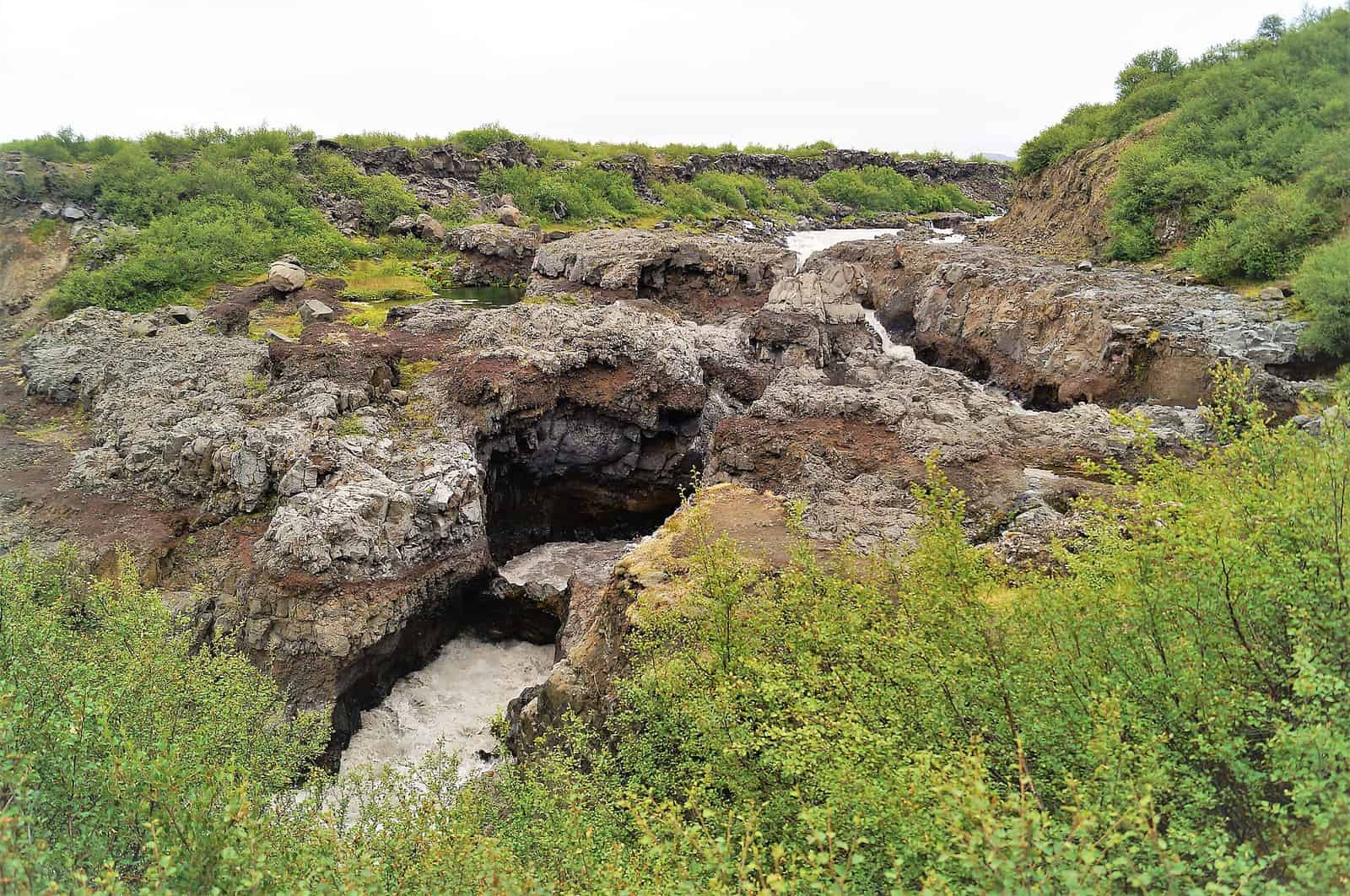
Hraunfossar is a long row of small falls that pour out from under the Hallmundarhraun lava into the Hvítá river in upper Borgarfjörður, and Barnafoss, just above them, is the narrow torrent that has cut bridges and arches into the rock. The walk links them on marked paths from one car park. It suits anyone with a free half-day out of Borgarnes, wheelchair users on the accessible sections, and anyone heading to Húsafell for the glacier or the lava cave. It costs no entry fee and about two and a half hours of a day from Borgarnes.
What the Environment Agency's page says, read on 1 November 2026: Hraunfossar is a group of spring-fed falls running from below Hallmundarhraun down to the Hvítá, protected as a natural monument since 1987; the reserve covers 36.1 hectares. Barnafoss lies just above it and is known for the bridges and rock arches the river has worn into the rock. The drive from Borgarnes is given as approximately 45 minutes. There are good, well-marked hiking trails with clearly defined viewpoints, good wheelchair access in parts, toilet facilities and an information sign at the main sites. The area is accessible all year round. Driving off road and outside marked trails is prohibited, as is cutting vegetation, disturbing wildlife or disrupting geological formations. The agency's page lists no fee.
The arithmetic
No ledger on this site visits upper Borgarfjörður, so the falls are an addition to a day rather than a stop on one. From a Borgarnes bed, where the seven-day Ring Road sleeps on night 6 and the ten-day Ring Road on night 7, it is 57 km and about 50 minutes each way by OSRM on OpenStreetMap (the agency says about 45). Add 45 minutes on the paths and a 15-minute buffer: about 160 minutes. Combined with Krauma at Deildartunguhver, which sits on road 50 about 24 km and 20 minutes back towards Borgarnes, the falls add about 100 minutes to the bath trip: 20 minutes each way beyond Krauma, 45 on foot and the 15-minute buffer. From Reykjavík it is 122 km and about 115 minutes each way, a full day only if combined with other stops.
What goes wrong
Ice: spray from the falls can freeze on the paths in cold spells. On the roads, Safetravel's winter-driving page asks for winter tyres, lights on at all times, extra time for the journey and a daily look at the forecast, and warns that wind and drifting snow can make roads dangerous even when they look clear; check road conditions before setting off. Crowds: the agency counts these falls among the most popular tourist destinations in West Iceland; early and late are quieter. Barnafoss: the water runs fast through a narrow channel; stay on the marked trails and at the defined viewpoints, as the agency's rules ask.
Alternatives on the same road
At the end of road 518, Víðgelmir is the guided walk through a lava tube and Into the Glacier leaves from Húsafell for the ice tunnel. On the way back, Krauma is the bath beside Deildartunguhver. Nearer Reykjavík, Glymur is the long waterfall hike in Hvalfjörður.
Questions people ask
Is it accessible?
Are there toilets?
Is it open in winter?
How long is the walk?
Sources we checked
Something changed here? Tell us; we re-check against the source and print the new date.
hike · Iceland · West
The arithmetic
- Time needed
- 30–60 min
- Adds to a driving day
- 2 h 40 min, door to door
- Price
- Free — Natural monument with no fee listed on the Environment Agency's page (ust.is, read 2026-11-01); read the sign at the car park.
- Season
- All year, by the Environment Agency; paths can ice in winter
- Book ahead
- None
- Best time
- Morning or evening, outside the Reykjavík day-tour hours
- From
- Hraunfossar and Barnafoss
- Checked
- 1 November 2026
What this page adds
A 160-minute cost from a Borgarnes bed (57 km and about 50 minutes each way by OSRM on OpenStreetMap, 45 minutes on the paths, a 15-minute buffer), or about 100 minutes on top of a Krauma visit, which already covers most of the drive.
Which day of which journey
The first ledger day that reaches Hraunfossar and Barnafoss, and what it costs that day: 2 h 40 min door to door.
- Iceland Westfjords loop in 6 days
Day 1 of 6: Reykjavík → Patreksfjörður, night in Patreksfjörður
1,020 kmChecked 1 November 2026 - Iceland Ring Road in 7 days
Day 6 of 7: Akureyri → Borgarnes, night in Borgarnes
1,555 kmChecked 1 November 2026 - Iceland Ring Road in 10 days with Snæfellsnes
Day 7 of 10: Akureyri → Borgarnes, night in Borgarnes
2,160 kmChecked 1 November 2026
More: waterfalls and walks